Taylor Wimpey have submitted a planning application to build a massive housing estate on the expanding fringes of Basingstoke, immediately adjacent to Croudace Homes’ equally massive development of Upper Cufuade Farm. If accepted, this proposal spells disaster for open countryside wildlife across the board, and cannot fail to have a damaging impact on the area’s migratory populations of amphibians.
In order for an objection to be taken seriously, it must provide evidence that is relevant to both environmental and planning law. As a result, this letter is necessarily lengthy, dry and detailed. If anyone else wants to object, feel free to copy and paste elements of the text, craft your own letter and send it as a word document attachment to planning.comments@basingstoke.gov.uk Make sure you include your name, address and postcode and say unequivocally ‘I object…’ Otherwise, your efforts will not count.
To: Basingstoke & Deane Borough Council, Planning Department, Civic Office, London Road, Basingstoke, RG21 4AH
Date: 11 February 2026
Application 25/02934/OUT – Land West Of Upper Cufaude Farm, Cufaude Lane, Bramley, Hampshire
I wish to object to the above application for the following summary reasons:
- the harmful and urbanising effect on the landscape, character and visual amenity of the area;
- the location of the proposed development, which is outside any existing settlement boundary;
- the harmful impact that this Taylor Wimpey development would have on the ecology and biodiversity of the local environment as a stand-alone development;
- the cumulative harmful impact on the environment and biodiversity of the area when this proposed development is seen alongside Croudace Homes’ housing estate development of what was once Upper Cufaude Farm;
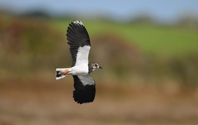
- the specific harmful impacts on locally important populations of notable and protected species, for example Great Crested Newt, Common Toad, bats and Hazel Dormouse.
1. Background
I am a wildlife author, conservationist, local resident and Cufaude Lane Toad Patroller and have explored the area’s natural history for more than 60 years. The land that embraces Cufaude Lane, stretching from MOD Bramley Army Camp to the National Trust Vyne Estate, harbours a mosaic of habitats and landscape features that point to its historic ancestry, and explain why its biodiversity is so rich.
2. General causes for concern
Over the last 10 years, the general Cufaude Lane area has been subjected to insidious inappropriate land use and wholesale habitat destruction (such as the development of Upper Cufaude Farm by Croudace Homes). As a result, it has experienced progressive environmental degradation and habitat loss leading to local declines (and in some cases extinctions) of open countryside wildlife (for example Brown Hare, Harvest Mouse, Grey Partridge, Tree Sparrow, Skylark and Barn Owl), species that were formerly common in the area; and erosion of the landscape as a historic visual amenity.
If permitted, development 25/02934/OUT will continue this destructive and urbanising trend. Overseen by Basingstoke & Deane Borough Council, it would be the final nail in the coffin for many open countryside species in the Cufaude Lane area. If this development is not refused, the legacy that the incumbent Council will leave for future generations is one of ruination of the local rural environment, extinction of open countryside species once common in the borough, and a visual scar on a historic landscape.
I am aware that this is an Outline Planning Application and an anticipated response from Basingstoke & Deane Borough Council planning officers is likely to be that Reserved Matters relating to the environment can be resolved at the next stage in the planning process. However, to adopt such an approach would be to ignore the fact that some developments are so potentially harmful and egregious in environmental terms they should never be allowed to proceed beyond the Outline Planning Application stage; instances where no amount of on-site mitigation and compensation could address the ecological destruction that the development in question would cause, and the impact on existing species in the landscape. Planning application 25/02934/OUT is just such a case in point.
As mentioned previously, I have been involved with the Cufaude Lane Amphibian Rescue Group (CLARG) as a volunteer for more a decade. During that time, a wealth of data has been collected alongside the primary role of the group which is animal welfare. No discussions have taken place between CLARG and Taylor Wimpey or their consultants. Consequently, as is clear from their EIA, any assertions made by them about the impact of the development on the local amphibian populations is based on speculation rather than information.
3. Specific reasons for objection
3.1 Urbanisation of a historic landscape and Settlement Boundaries
In historic terms, the beauty of the landscape to the north and west of this proposed development lies in its network of irreplaceable habitats that stretch to the National Trust’s Vyne Estate and beyond. Given the unchanging continuity of land-use over the centuries, it is little wonder that area is so rich in biodiversity.
The proposed development would be entirely unsympathetic to, and would harmfully erode, the landscape character and visual quality of the area. It would also erode and potentially destroy local distinctiveness and a sense of place, making it contrary to Policies EM1 and EM10 of the Basingstoke and Deane Local Plan 2011-2029.
BDBC policies state that development outside Settlement Policy Boundaries (SPBs) should be tightly restricted – this is emphasised in the current Local Plan and policies map. It also states that SPBs should protect the countryside from inappropriate development.
The proposed development lies within the parish of Bramley and outside its Settlement Boundary. Policy H1 of the Bramley Neighbourhood Plan provides for housing numbers within and adjacent to its Settlement Policy Boundary and these numbers are met without this development. The Bramley Neighbourhood Plan states that no development should occur outside the Parish Settlement Policy Boundary other than small scale rural exceptions of affordable housing in accordance with Local Plan Policy CN2 and SS6, New Housing in the Countryside. This site proposal clearly does not meet those policy requirements.
This proposed development would also conflict with NPPF Para 89 in that the development would have an unacceptable impact on local roads.
The proposed development would conflict with NPPF24 Para 135 in that it would damage the landscape setting of SINCs and Ancient Woodland as well as the views from the Grade 2 and 1 Assets of The Vyne National Trust property.
The proposal of Green Space in the Northern section of the site is totally inadequate and fails to meet NPPF24 Para 187 sections a) and b). Furthermore, the submitted Environmental Statements contain inadequate and insufficient detail to enable even Outline planning permission to be given. NPPF24 Para 198 would render this proposal unacceptable based on the cumulative impact on the natural environment from light, noise, and pollution.
Many aspects of the proposed development would also conflict with guidance in BDBC’s Design and Sustainability Supplementary Planning Document (2018) and the Landscape, Biodiversity and Trees Supplementary Planning Document (2018).
3.2 Destruction of open countryside and the environmental cost
Stating the obvious, building houses and associated brick, tarmac, concrete infrastructure on open countryside destroys forever the value of the land for wildlife that has evolved to live in this habitat. Putting it bluntly, species such as Skylarks, Barn Owls and Harvest Mice cannot live in housing estates. The destruction of open countryside to build houses means these species will become extinct on the land the buildings occupy. That is as inevitable as it is unacceptable to anyone who values the natural world and understands the obligations and legally-binding targets placed on local authorities by the Environment Act 2021 to not only protect but enhance existing biodiversity, in particular notable and legally protected species.
The proposed development includes areas designated as green spaces and the developers Taylor Wimpey would presumably argue that this is their on-site contribution to nature. However, that is not the case because, human nature being what it is, inevitably all such areas would end up becoming multi-use areas, rendering them worthless to any species that are sensitive to disturbance – the very species that need safe havens, having lost them to development. Species that have been evicted from the rest of the land would never be able to exist with constant disturbance by humans and dogs; and predation by cats would render the land useless to the likes of small mammals such as Harvest Mouse and Hazel Dormouse, reptiles and amphibians, ground-nesting birds such as Skylark, and winter-feeding flocks of Yellowhammers and other farmland songbirds.
3.3 Impact on Cufaude Green Lane
The northwest corner of the proposed development abuts a stream that is framed along its length by ancient woodland. The byway, known locally as Cufaude Green Lane, is being considered by Hampshire Biodiversity Information Centre (HBIC) for designation as a Site of Importance for Nature Conservation (SINC). Local naturalists have submitted data to HBIC and HBIC has undertaken a survey of its own. In anticipation of SINC-designation occurring in the next few months (i.e. within the timescale of the planning decision-making process) the harmful impact of the development on this ancient byway must be considered.
I have two primary concerns in regard to the proposed development and Cufaude Green Lane: the proximity of the development to key landscape features and the absence of adequate and appropriate environmental buffer zones; and the inevitable flooding impact and pollution of the stream at the heart of Cufaude Green Lane, caused by run-off. For further discussion of this topic, see section 3.6
3.4 Proposed Combined Cycle Track and Footpath.
One of the most environmentally harmful elements of the proposed development is the creation of a Cycle Connection/Combined Cycle Track and Footpath. Firstly, it should be noted that neither as a Cycle Track nor a Footpath does the proposal serve any purpose in the context of sustainability. The likelihood is that any residents of the housing estate employed locally and cycling to work would find employment to the south of the housing estate in and on the fringes of Basingstoke.
A Cycle Track/Footpath leading north would only be used recreationally and it would be the height of folly to encourage cyclists to enter Cufaude Lane at any point along its length. Likewise, for pedestrians, it would be irresponsible to encourage them to walk along a narrow road that is already extremely dangerous. The danger will only increase as traffic increases year-on-year, the result of increasing house building at either end of this byway.
I have walked Cufaude Lane hundreds if not thousands of times on Toad Patrol over the last 10 years. Along most of its length, it is subject to the National Speed Limit (i.e. 60 mph); despite the narrow width and blind bends in the road, like other patrollers I routinely encounter motorists who regard the speed limit as a target. Personally, were it not for my commitment to Toad Patrol, I would never walk along Cufaude Lane for recreation because it is such a dangerous and unpleasant experience.
Having scrutinised the current plans, of particular concern is the environmental destruction that would result from the proposed access point of the Potential Cycle Connection/Combined Cycle Track and Footpath to Cufaude Lane; this also happens to be one of the most dangerous stretches of the highway.
It is the stated intention of the developers to grub out a section of the hedgerow and engineer the landscape to accommodate access. Any such destruction of irreplaceable wildlife-rich habitat is unacceptable. However, when subjects such as ‘visibility’ are introduced into the equation, and when taken alongside the red line boundary of the application site (which covers both sides of the road), the potential for damage is far greater. The proposal is loosely-worded enough to allow for far greater destruction of and harmful impact on ancient landscape features including hedgerows, banks and veteran trees.
The applicant’s document for the Potential Cycle Connection (iTransport ITB201069-GA-010) states clearly that it is issued for Feasibility Consideration. The visibility splays are quoted as 47m to the left/north and 49m to the right/south. The proposal needs surveying accurately (as this is an Outline Planning Application with all matters reserved except for access) but even with the quoted visibility splays the feasibility drawing shows more than 50% of the Ancient Hedgerow depth being destroyed in order to create an extremely dangerous access point.
As this is a 60mph road, the visibility distances should be 215m.
At its proposed access point to Cufaude Lane, the 3.5m-wide Combined Cycle Track and Footpath has only a central bollard to prevent vehicle access. This will invite access from e-bikes, quad bikes and ATVs. For that reason alone, it should not form part of the site access proposal. Any access to Cufaude Lane from the housing estate will inevitably lead to an increase in anti-social behaviour and rural crime, examples of which toad patrollers routinely witness already while on toad patrol. Resulting anti-social behaviour would undoubtedly include quad bike- and scramble bike-users, who would become aware of and use Cufaude Green Lane as a circular route. As to other forms of anti-social behaviour, without going into detail, pull-off spots on the road are already used now and then for what might be described as ‘nocturnal in-car entertainment’ and vehicle ‘hand-overs’ have been observed.
Returning to environmental concerns, given the number of records in the vicinity, the stretch of hedgerow and bank proposed for impact and destruction is likely to provide habitat and connectivity for Hazel Dormice, and be resting place habitat for Great Crested Newts. Despite the assertion in the applicant’s EIA about proximity of Great Crested Newts (GCN) to the proposed development site, CLARG volunteers have regular encounters with GCN on the stretch of road adjacent to the proposed northern section of the Cycle Track/Footpath and the site of proposed habitat destruction.
The stretch of hedgerow and bank proposed for destruction hosts veteran oak trees that offer roosting opportunities for bats.
In addition, of particular concern is the a harmful if not catastrophic impact this habitat destruction and alteration of the landscape would have on locally- and nationally-important populations of migrating Common Toads and other amphibians. At its northern limit, the suggested route of the Cycle Track/Footpath adjacent to Cufaude Lane is sited alongside a sloping section of the road that is fast becoming the most important migration zone for the southern population of Common Toads and other amphibians on Cufaude Lane.
If permitted, a Combined Cycle Track and Footpath in this location would place yet another obstacle in the path of migratory amphibians and would double their risk of death: they would have to face being killed by cars on the road, and then risk being squashed under foot and cycle tire as well. To save lives and minimise the risk of local extinctions of migratory species such as Common Toads and Great Crested Newts, CLARG volunteers would have to literally double their efforts and patrol both the Road and the Combined Cycle Track and Footpath.
Interestingly, the developer’s EIA confirms the ecological significance of this parcel of land and actually provides additional reasons why a Cycle Path/Footpath in this location would be environmentally harmful. Of particular interest are the cluster of records for Grass Snake, Common Lizard and Slow-worm.
If you wanted to maximise harmful environmental impact, you could hardly pick a better location to site a Cycle Track and Footpath.
For all the above reasons, the proposed Combined Cycle Track and Footpath should be specifically commented on by BDBC Transport, Active Travel England, Designing Out Crime, BDBC Environmental Health, BDBC Biodiversity and Natural England because of the inevitable Environmental Destruction it would cause, and the rise in Anti-social Behaviour and Crime it would encourage.
3.5 Destruction of habitat for Hazel Dormouse
Mention is made in the proposed development’s EIA of the removal of hedgerows within the site. Given that Hazel Dormice live quite happily in hedgerows and are acknowledged as having been recorded doing so nearby, such a proposal represents the intentional destruction of habitat for this protected species. Furthermore, destroying hedgerows removes connectivity in the landscape not only for this species but also many other species of wildlife. In this day and age, I would have hoped that any enlightened and environmentally responsible developer would want to avoid harming the long-term prospects of a protected species. That appears not to be the case with Taylor Wimpey.
3.6 Proposed flood risk mitigation measures
Among the many environmental misgivings that I have about proposals for mitigation of flooding, the most troubling is described in the reports as a ‘significant downstream secondary basin’ in the north of the development. My concerns relate to location and pollution.
The applicant’s various flood risk reports cover topics such as ‘rainwater harvesting’ and ‘separate grey water plumbing’. Putting aside the sanitised jargon, in essence what is being discussed is that the function of this ‘significant basin’ is to become a sink-hole for floodwater from the housing estate and a repository for foul water when the sewer system is overwhelmed. Mention in the same breath of ‘significant basin’ and ‘benefits for toads’ would be laughable were it not so serious.
In terms of harmful environmental impact, you could hardly pick a worse location for the ‘significant basin’. It is perilously close to the stream at the heart of SINC-proposed Cufaude Green Lane, which already floods routinely during the winter months. In periods of particularly heavy rainfall the ‘significant basin’ could hardly fail to overtop and contribute to flooding of the stream.
From the perspective of Common Toads, flooding of the stream (which already frequently occurs during peak migration periods) presents a major hazard to the animals, which get washed downstream. Any Common Toads or amphibians that did attempt to breed in the ‘significant basin’ would face the risk of pollution by contaminated water (both from the housing estate site and Cufaude Lane itself); flooding and overtopping of the ‘significant basin’ while breeding was in progress would mean paired animals and spawn being flushed from the site into the stream and killed; and the proximity of the ‘significant basin’ to the road would inevitably mean increased casualties as post-spawning animals dispersed onto the road only to be killed by passing cars.
Incidentally, the ‘significant basin’ is immediately adjacent to the proposed access point of the environmentally harmful stretch of Cycle Track/Footpath onto Cufaude Lane.
3.7 Natural Basingstoke’s Cufaude Lane Nature Protection and Enhancement Proposal
Natural Basingstoke is an umbrella charity that represents conservation organisations in Basingstoke; it works alongside the local council. In the absence of meaningful strategic environmental planning by the council, I have been working with Natural Basingstoke to develop a Cufaude Lane Nature Protection and Enhancement Proposal; if adopted, this would create Green and Blue Corridors for wildlife from the Bramley MOD Army Camp west across the National Trust Vyne Estate to Manor Farm in Sherborne St John. The proposal has the support of the Hampshire and Isle of Wight Wildlife Trust and Wild Justice.

The housing estate proposed by Taylor Wimpey would have a compromising and harmful impact on the chances of this ambitious and worthy goal achieving success.
Yours sincerely,
Paul Sterry, Naturalist, Wildlife Author and Conservationist.
